

Mt. Apo stands as the highest mountain in the Philippines rising 2956 Meters Above Sea Level. Also considered the grandfather of Philippine mountains and a sacred place in local mythology, Mt. Apo is an important climb, especially for local mountaineers. Those seeking to experience its trails will also find themselves immersed in the rich culture of the people living at the foot of the mountain. And attracts a lot of attention from hikers all over the world.
The peak overlooks Davao City 45 kilometres (25 mi) to the northeast, Digos City 25 kilometres (16 mi) to the southeast, and Kidapawan City 20 kilometres (12 mi) to the west.

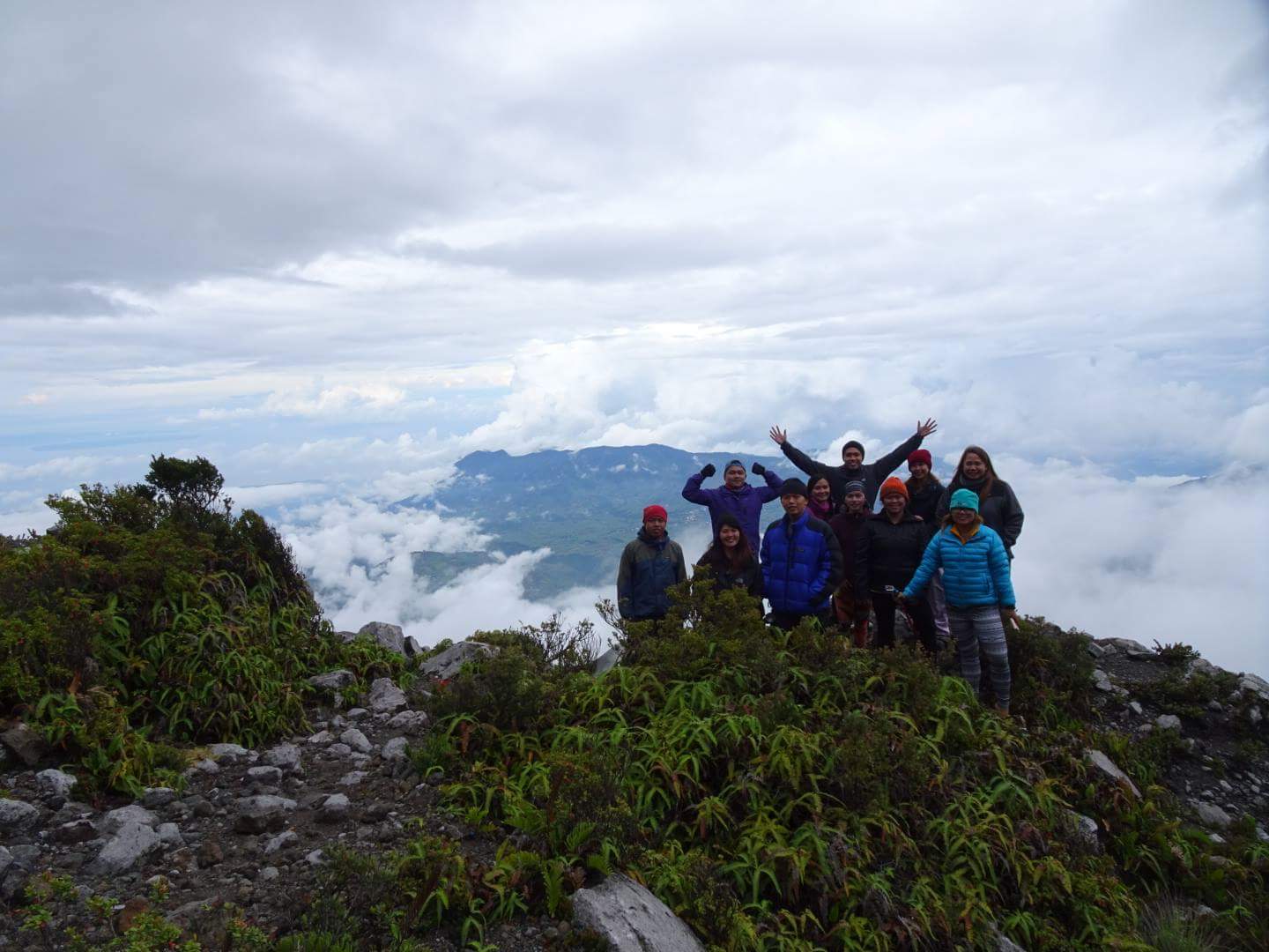
Mt. Apo possesses a formidable array of landscapes, from craggy rockscapes to virgin forests; from mossy swamps to volcanic structures. The mountain possesses the widest spectrum of environments, and provides an experience for mountaineers that lives up to their expectations from the country’s highest.
Mt. Apo is the habitat of some of the rarest kinds of animals in the country. If you are lucky, you may even get a close encounter with the Philippine Eagle.
Mount Apo is one of the must see and experience for every adventure tourist or backpacker who visits the country specially in the Davao Province where it lies.
With its panoramic views and diverse scenery, Mt. Apo offers an adventure of a lifetime. The area features an array of landscapes, virgin forests, crags, rivers, lakes, mossy swamps, volcanic structures, and crater of sulphuric deposits.
The water level in Lake Venado may swell, decreasing the size of the campsite. The weather in Mt. Apo is very unpredictable; strong rains may just come. Rely on local knowledge on whether to pursue river crossings in bad weather.

HISTORY
The first two attempts to reach Mt. Apo’s summit ended in failure: that of Jose Oyanguren (1852) and Señor Real (1870). The first recorded successful expedition was led by Don Joaquin Rajal in October 10, 1880. Prior to the climb, Rajal had to secure the permission of the Bagobo chieftain, Datu Manig. It is said that the Datu demanded that human sacrifice be made to please to god Mandarangan. Fortunately, the datu agreed to waive this demand, and the climb commenced on October 6, 1880, succeeding five days later. Since then, numerous expeditions followed. These and more are described in colorful narrations by Fr. Miguel Bernad, S.J.
On May 9, 1936, Mount Apo was declared a national park by President Manuel L. Quezon.

A note on the etymologies: Mt. Apo is said to be named after a nobleman named Apong, who got killed while mediating the battle between two suitors of his daughter Saribu. Another proposed origin of the name is from the word Apo itself, which in Filipino tongues means “master” or “grandfather”. - http://wikitravel.org
The Boulders of Mt. Apo is one of the famous feature which would led to a breath taking experience by ascending the crater of sulfur deposits and vents. Along the boulders, picture taking and nibbling of sweet wild berries can be tried before arriving at the 87-degree cliff before leading the way to the country’s highest peak.
THE TRAIL (http://www.mtapoadventures.com/about-the-mountain/)
SIBULAN TRAIL - Sta. Cruz, Davao del Sur , Philippines

Considered as the most technical and interesting trail because of its narrow and different type of trail with very lush vegetation and pristine jungle which you can see the canopy ecosystem and different species of Flora & Fauna.
Its trail starts at a small village call Baruring, Sibulan, Sta. Cruz, Davao del Sur which a back packer would pass a farm trail, jungle trail and boulders trail before reaching the summit covering a distance of 13.7 Km with elevaion gain of approximately 2,000 meters from the trail head.
KO-ONG KIDAPAWAN TRAIL - Kidapawan, North Cotabato, Phils.
Mostly used trail that is why it has the widest trail of them all which starts in then Kidapawan, North Cotabato. This trail offers a river trail , jungle trail and grassland assault upon reaching the summit. Although a little bit far the covers approximately 19 Km ,the experience in trekking this trail is also challenging.
KAPATAGAN TRAIL - Digos, Davao del Sur, Philippines
This trail is an adjacent trail of Sibulan trail but a little longer in distance by est. 2 Km with wider trail together with some obstacle along the way.
TAMAYONG TRAIL - Davao City, Philippines
Unofficially open trail to Mt. Apo which is considered as the toughest and longest way to the peak which makes climbers pass the Mt. Talomo Peak making it a double Major climb.
Seven(7) different peaks can be seen at the summit of Mt. Apo and peak hopping is the best thing to do. In one of those peaks , you can feel being in an enchanted world by experiencing its epic sunset and in the morning , you can experience the mystic sunrise which gives unimaginable pleasure and under very good weather , you will observe the following : Davao side, South Cotabato’s Mt. Matutum, Lake Venado an other surrounding provinces.
MAP:


No comments:
Post a Comment